Tiahuanaco (Tiwanaku)
Early in January of 1998, I bought an old Volkswagen van and began a long drive to the lower reaches of South America. Over the next year, rambling 22,000 miles on rough mountain roads and muddy jungle tracks, I visited and photographed more than 150 sacred sites and power places in fourteen different countries. Eight months into the journey, I ascended the Altiplano regions of Peru and Bolivia to spend ten weeks crisscrossing the Andean mountains. The Andes birthed several great cultures, including the Inca and Tiahuanaco (also spelled as Tiwanaku). While the Inca Empire is better known and its sites more numerous and visually remarkable, Tiahuanaco is the true sacred center of the Andean region (an earlier name of the site was typical, meaning the ‘rock in the center’).
Now almost entirely in ruins, Tiahuanaco is to South America what the Great Pyramid is to Egypt, and the Avebury stone ring is to England. Twelve miles from the coast of the sacred Lake of Titicaca, Tiahuanaco was the source of the creation myths, the social order, and the extraordinary preoccupation with astronomy that underwrote thousands of years of Andean culture. Yet, for all its importance, Tiahuanaco remains an enigma. This is not because the ruins have not been excavated or studied. Instead, the reason for the enduring mystery of Tiahuanaco derives from some of its structures - and the astronomical alignments of those structures - that indicate a probable construction period far more ancient than any other monumental archaeological site in all of South America.
Driving to Tiahuanaco from Lake Titicaca (where I had spent several days camping on the Islands of the Sun and Moon), I found myself again thinking about several questions that had been with me during my long travels from Sedona. Was South America originally inhabited by Paleo-Indians walking across the Bering land bridge during past ages of polar glaciation (the orthodox assumption) or had there been pre-existing sophisticated cultures that had mysteriously disappeared (the alternative theory)? Was there any factual reality behind the many Andean myths of great cataclysms and enormous floods in archaic times? Who was the legendary hero/savior Viracocha that supposedly re-seeded civilization into the Andean regions following the cataclysm? And what is the meaning behind the astonishing stories of contact, indeed settlement, from the mythic land of Atlantis?
Here is one variant of the myth of Viracocha. Long ago in a forgotten time, the world experienced a terrible storm with tremendous floods. The lands were plunged into a period of absolute darkness and frigid cold, and humankind was nearly eradicated. Sometime after the deluge, the creator god Viracocha arose from the depths of Lake Titicaca. Journeying first to the island of Titicaca (now called Isla del Sol or the Island of the Sun), Viracocha commanded the sun, moon, and stars to rise. Next, going to Tiahuanaco (whose original name, taypicala, meant ‘the rock in the center’), Viracocha fashioned new men and women out of stones and, sending them to the four quarters, began the repopulation of the world. With various helpers, Viracocha then traveled from Tiahuanaco (also written as Tiwanaku), bringing civilization and peace wherever he went. Known by other names, including Kon Tiki and Tunupa, he was said to have been a bearded, blue-eyed, white man of large stature. Viracocha, a teacher, a healer, a miracle worker, and an astronomer, is also credited with introducing agriculture, writing, and metallurgy.
I had been reading about Viracocha’s pilgrimage to Tiahuanaco for twenty years and was enchanted to have finally arrived myself. The first thing I noticed is that Tiahuanaco is not a grand visual spectacle, such as the ruins of Machu Picchu, Palenque, or Teotihuacan. The excavated central part of the city is relatively small, and one can walk across it in fifteen minutes. Additionally, there are not a large number of structures to be seen because so much has been stolen and carted away over the centuries. The next thing I observed was that the site appeared to be much, much older than the primary construction and habitation period postulated in orthodox archaeology theory.
This conventional theory assumes that the civilization that spawned Tiahuanaco arose around 600 BC and fell into decline sometime soon after 1000 AD. Yet, something about this relatively recent dating didn't fit my impression of the place. With more than thirty years of experience exploring and photographing hundreds of archaeological ruins, I have developed a sense of gauging the antiquity of these places, and the remains of Tiahuanaco felt much older than just 2500 years. The site's orientation was different, too; it had a most unusual style. It seemed to have been designed and crafted by people with artistic, scientific, and philosophical sensibilities distinctly different from those of other pre-Columbian cultures.
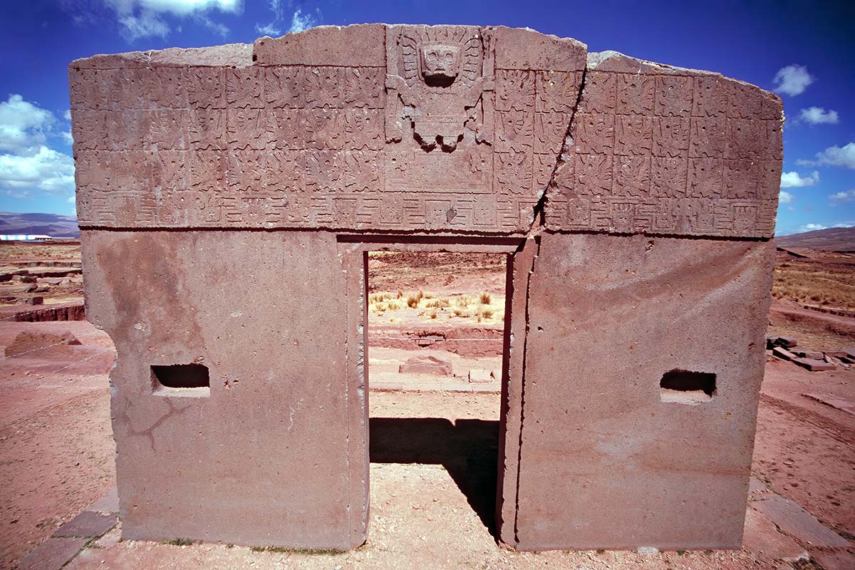
This same sort of feeling is what motivated Arthur Posnansky, a German-Bolivian scholar, to study Tiahuanaco exhaustively for almost fifty years. Living in the ruins and intimately familiar with them, Posnansky noticed dozens of things that could not be explained by conventional archeological theory and did not fit into its chronological framework. For example, all over the site were enormous blocks of stone that no known pre-Columbian culture had the technology to transport. Even more astonishing, the spatial arrangement of these structures - relative to one another and the stars above - indicated that the initial site engineers had a highly sophisticated knowledge of astronomy, geomancy, and mathematics. Let us briefly tour some of these structures and reflect on their remarkable qualities.
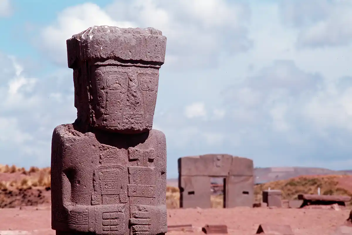
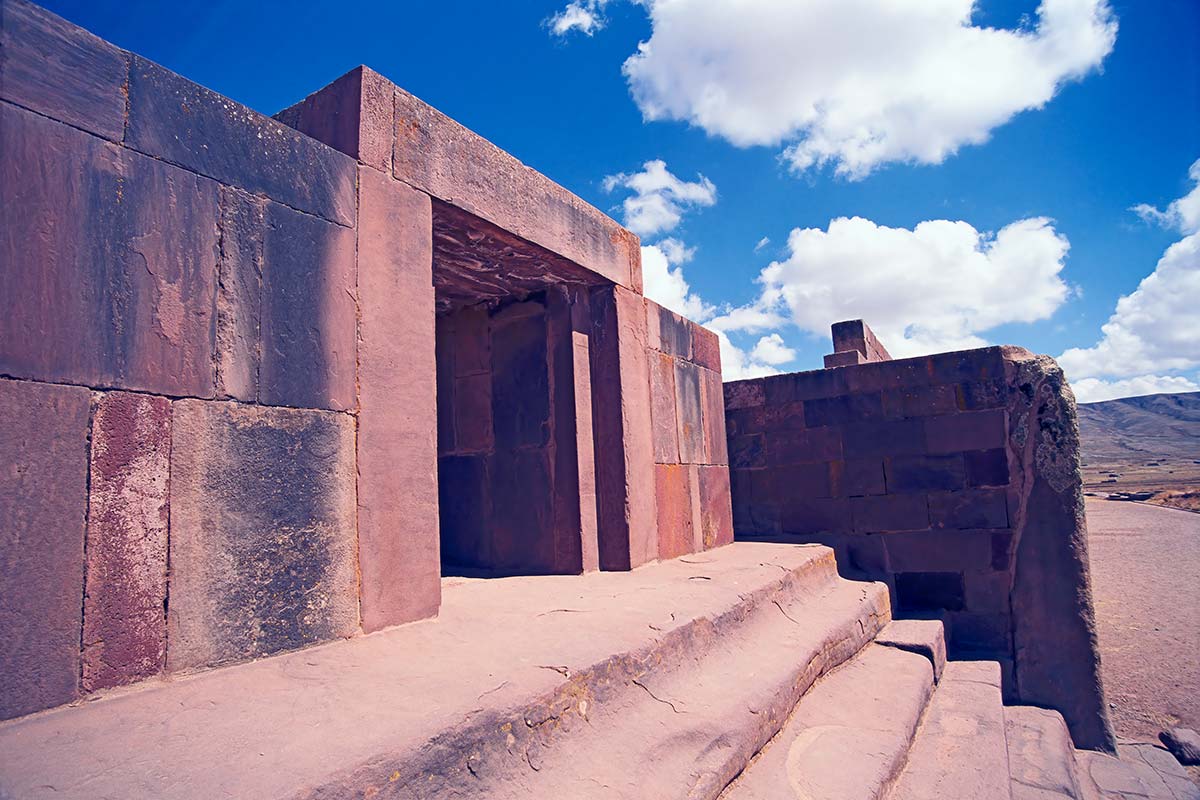
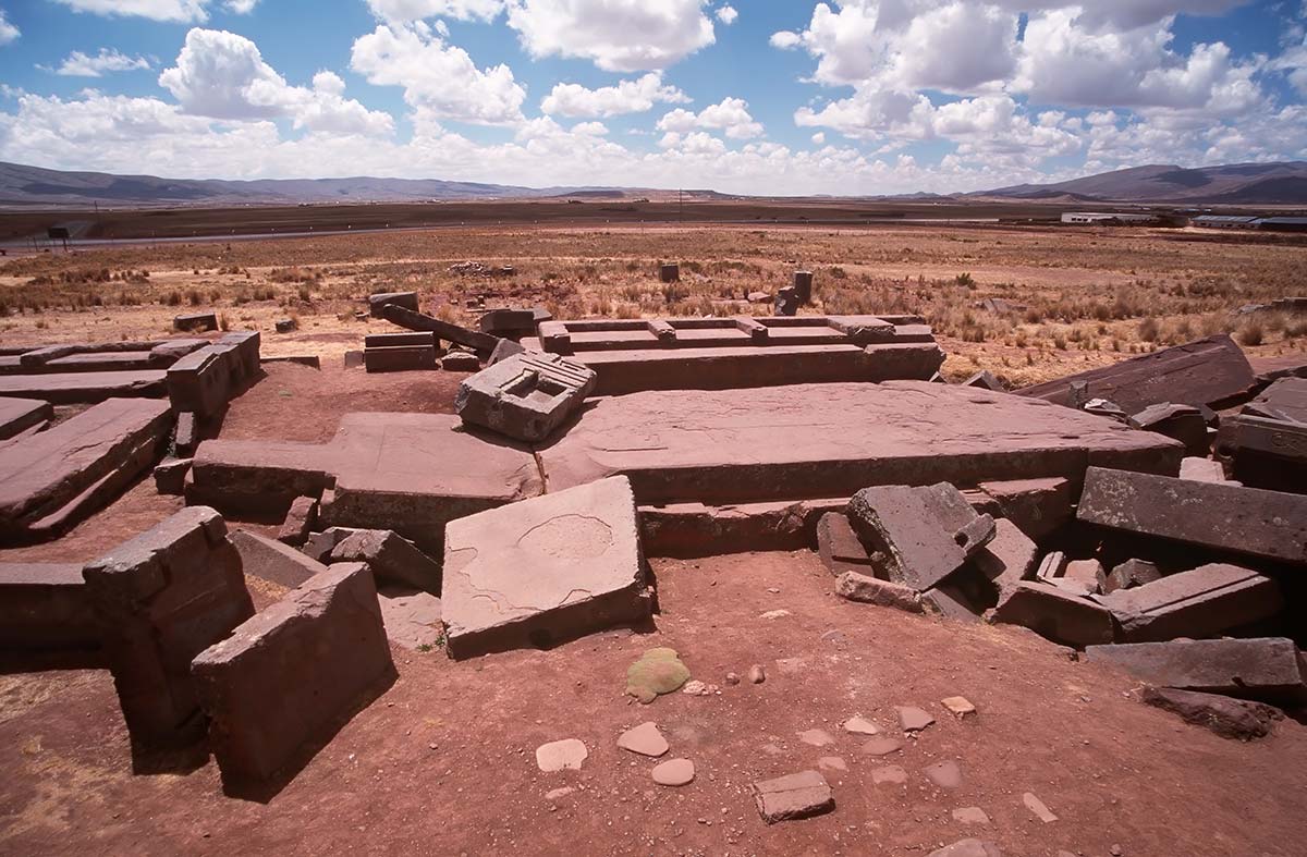
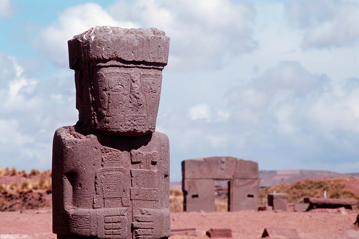
Tiahuanaco has four (surviving) primary structures, called the Akapana Pyramid, the Kalasasaya platform, the Subterranean Temple, and the Puma Punku. The ceremonial core of Tiahuanaco was surrounded by an immense artificial moat that archaeologist Alan Kolata believes was “not to provide the Tiwanaku elite with a defensive structure but rather evoked the image of the city core as an island, not a common, generic island, but the sacred island of Titicaca, the mythic site of world creation and human emergence.” Further commenting on this idea of the mythic centrality of Tiahuanaco, Kolata explains that, “the true name of Tiwanaku was Taypikhala, ‘the stone in the center.’ Such a name had a geocentric and ethnocentric meaning, signifying that the city was conceived not only as the political capital of the state but also as the central point of the universe.”
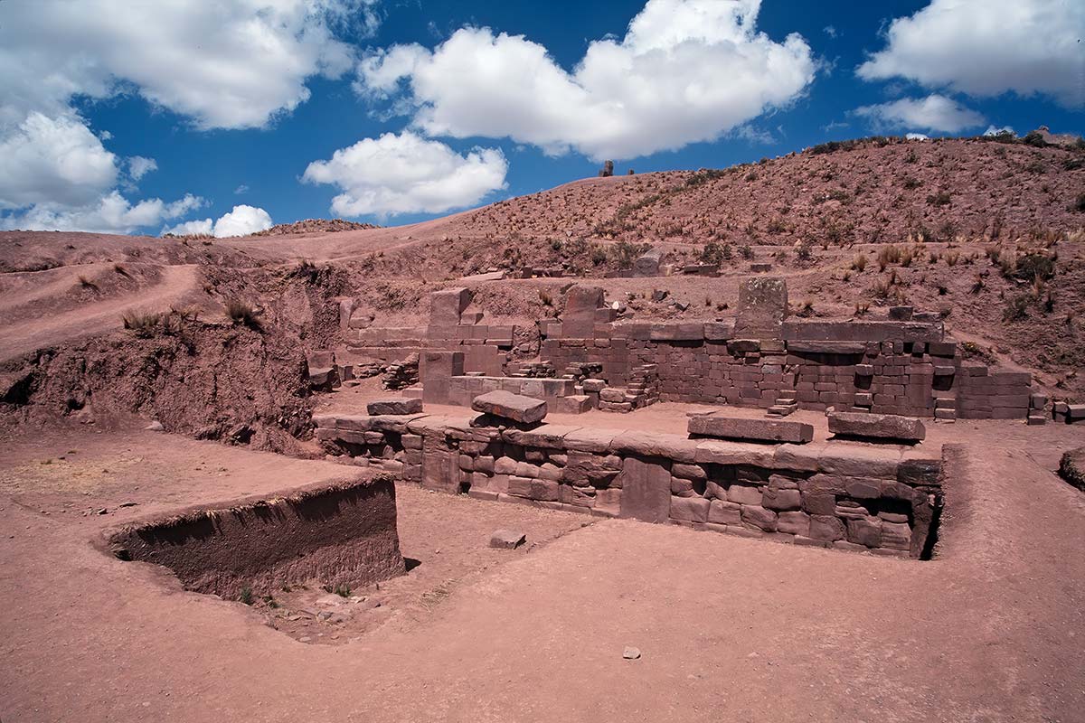
The Akapana Pyramid, sometimes called the sacred mountain of Tiahuanaco, is a much eroded, seven-level pyramid measuring 200 meters on a side and nearly 17 meters tall. Like the nearby Subterranean Temple and the Kalasasaya, the Akapana is precisely oriented to the cardinal directions. Each of the seven levels is constructed with beautifully cut and precisely joined blocks that were faced with panels once covered with metal plaques, carvings, and paintings. In the center of the Akapana's flat summit is a small, sunken courtyard laid out as a square superimposed over a perfect cross; this courtyard is also oriented to the cardinal directions. Recent excavations of this courtyard, the interior of the pyramid, and the grounds beneath it have revealed an unexpected, sophisticated, and monumental system of interlinked surface and underground channels. These channels brought water collected upon the summit down and through the seven levels, where it exited below ground level, merged into a significant subterranean drain system underneath Tiwanaku's civic/ceremonial core, and ultimately flowed into Lake Titicaca.
Commenting on this magnificent engineering, Kolata states, “It is apparent that the complex system of draining the Akapana was not a structural imperative. A much simpler and smaller set of canals could have drained the accumulated water from the summit. In fact, the system installed by the architects of Akapana, although superbly functional, is over-engineered, a piece of technical stone-cutting and joinery that is pure virtuosity.” Kolata goes on to wonder about why all this work was done and concludes that “the Akapana was conceived by the people of Tiwanaku as their principal emblem of the sacred mountain, a simulacrum of the highly visible, natural mountain huacas (sacred places) in the Quimsachata range...The Akapana was Tiwanaku’s principal earth shrine, an icon of fertility and agricultural abundance. It was the mountain at the center of the island world and may even have evoked the specific image of sacred mountains on Lake Titicaca’s Island of the Sun. In this context, the Akapana was the principal huaca of cosmogenic myth, the mountain of human origins and emergence, which took on specific mytho-historic significance.”
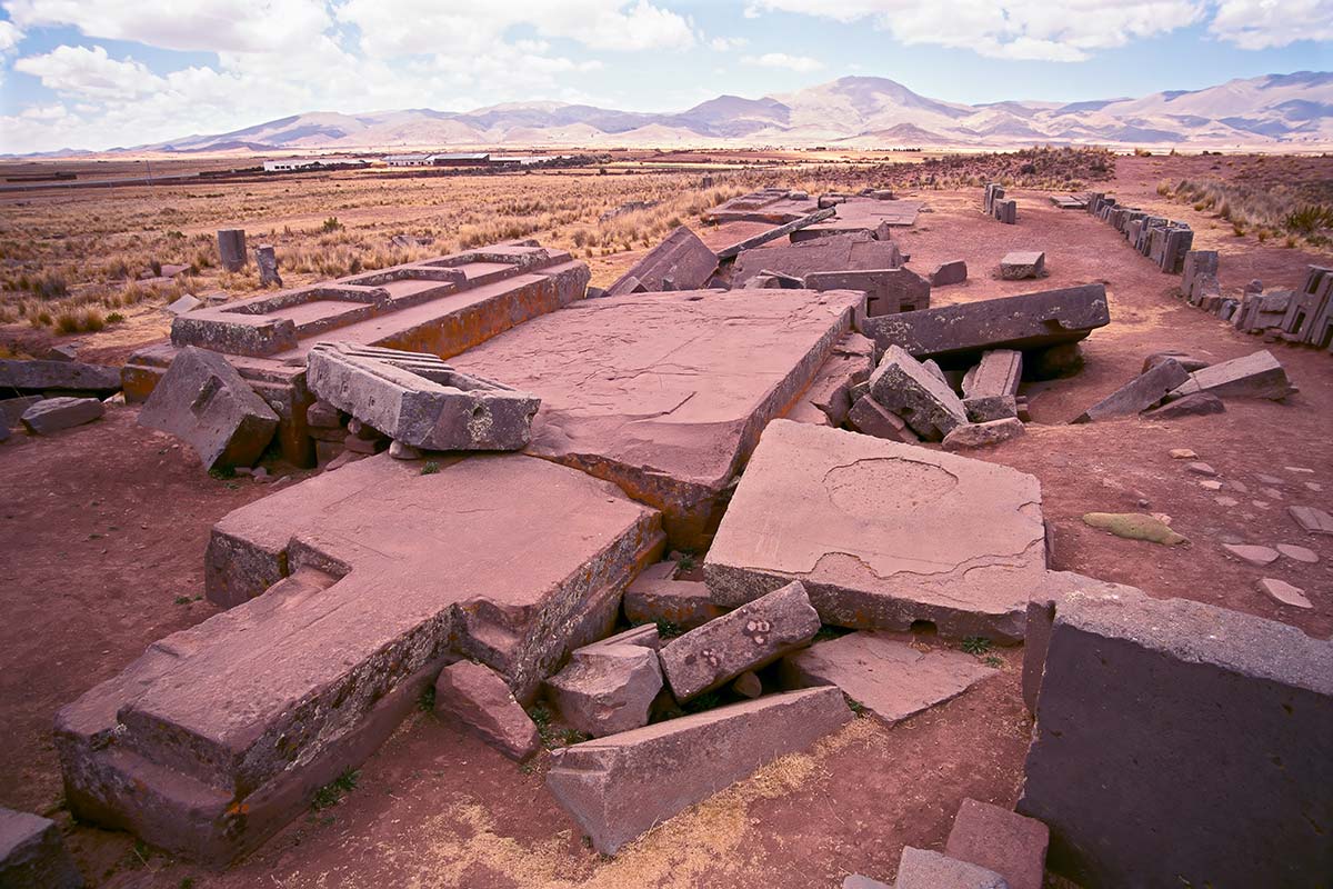
The structure known as the Puma Punka also startles the imagination. It seems to be the remains of a great pier and a massive, four-part, now collapsed building, and this makes sense for Lake Titicaca long ago bordered the shores of Tiahuanaco, now twelve miles inland from the lake. One of the construction blocks from which the pier was fashioned weighs an estimated 440 tons (equal to nearly 600 full-size cars), and several other blocks are between 100 and 150 tons. The quarry for these giant blocks was on the western shore of Titicaca, some ten miles away. No known technology in the ancient Andean world could have transported stones of such massive weight and size.
With their simple reed boats, the Andean people of 500 AD could certainly not have moved them. Even today, with modern advances in engineering and mathematics, we cannot fashion such a structure. How were these monstrous stones moved, and what was their purpose? Posnansky suggested an answer based on his studies of the astronomical alignments of Tiahuanaco, but that answer is considered so controversial, even impossible, that it has been ignored and criticized by the scientific community for more than fifty years. As such, it hasn’t made it into the mainstream history books, and therefore, hardly anyone knows of the astonishing implications of Posnansky’s findings.
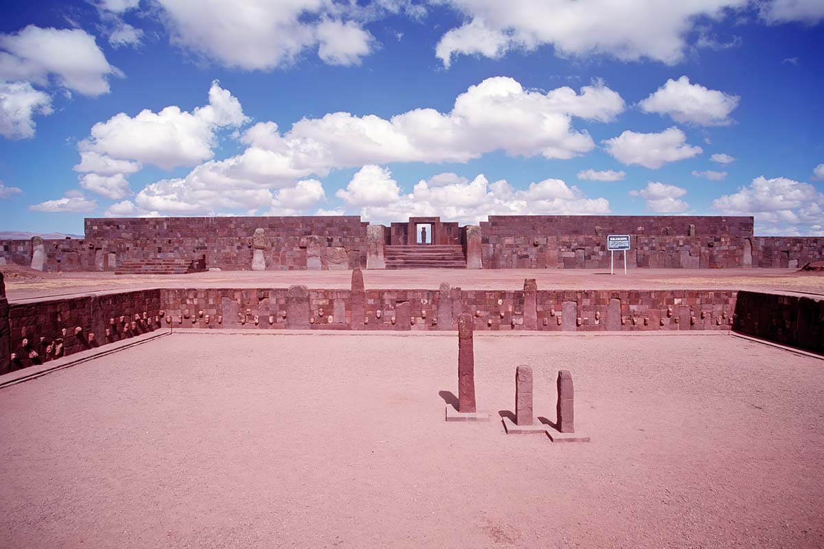
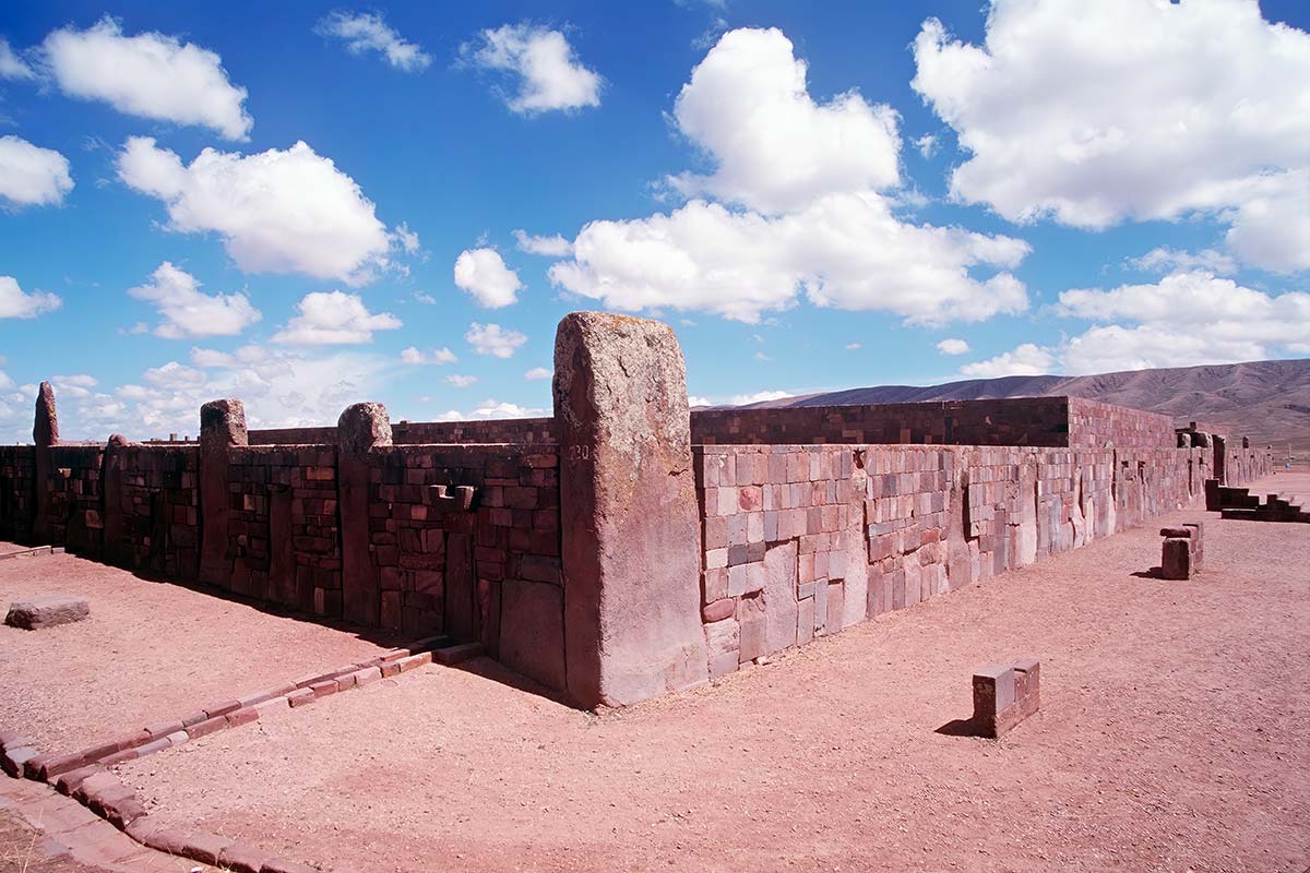
Nearby the Puma Punka and the Akapana Pyramid are the Kalasasaya compound and the so-called Subterranean Temple. It was in these structures that Posnansky made the discoveries that led him to suggest both a great antiquity for Tiahuanaco and an extraordinary use. As part of his studies, Posnansky conducted precise surveys of all the principal structures of Tiahuanaco. The Kalasasaya structure, a rectangular enclosure measuring about 450 feet by 400 feet, was delineated by a series of vertical stone pillars (the name Kalasasaya means “the standing pillars”) and had an east-west orientation. Utilizing his measurements of the lines of sight along these stone pillars, the orientation of the Kalasasaya, and the purposely intended deviations from the cardinal points, Posnansky was able to show that the alignment of the structure was based upon an astronomical principle called the obliquity of the ecliptic.
This term, the obliquity of the ecliptic, refers to the angle between the plane of the earth’s orbit and that of the celestial equator, equal to approximately 23 degrees and 27 minutes at the present. The tilt of the obliquity, however, changes very slowly over great periods of time. Its cyclic variation ranges between 22 degrees, 1 minute, and 24 degrees, 5 minutes over a period of 41,000 years or 1 degree in 7000 years (this cycle is not to be confused with the better known precessional cycle of 25,920 years or 1 degree of movement every 72 years). The figure that Posnansky determined for the obliquity of the ecliptic at the time of the building of the Kalasasaya was 23 degrees, 8 minutes, and 48 seconds. Based on these calculations, Posnansky was able to date the initial construction of the Kalasasaya and Tiahuanaco to 15,000 BC. A team of four leading astronomers from various prestigious universities in Germany later confirmed this date.
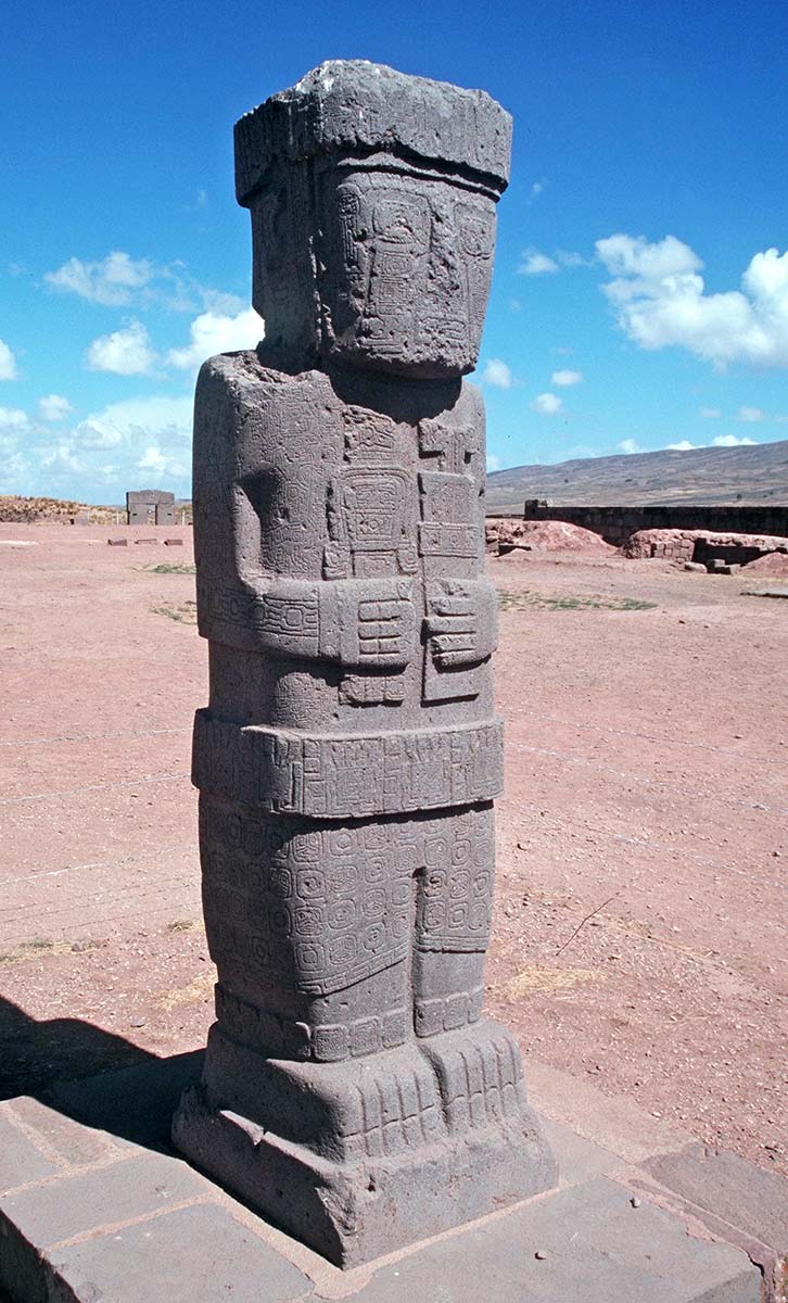
This initial construction date, being vastly older than that deemed possible by the prevailing paradigm of history, was (and still is) ridiculed by mainstream archaeologists and prehistorians. However, it is not so easy to dismiss Posnansky’s findings as there are other mysteries concerning Tiahuanaco that seem to confirm the great antiquity of the site. Among these are the ancient myths of Tiahuanaco (from throughout the Andean region) that tell of its founding and use in a pre-flood time; the scientific studies that prove a cataclysmic flood did indeed occur some twelve thousand years ago; the utensils, tools, and the fragments of human skeletons that are mixed in with the deepest layers of the flood alluvia (indicating human use of the site before the great flood); and the strange carvings of bearded, non-Andean people that are found around the site (replete with sculptural and iconographic details that are unique in the western hemisphere).
Posnansky and other writers, such as Graham Hancock, Zecharia Sitchin, and Ivar Zapp, have suggested that these findings and the astronomical alignments of the site strongly point to the likelihood that the original Tiahuanaco civilization flourished many thousands of years before the period assumed by conventional archaeologists. Rather than rising and falling during the two millennia around the time of Christ, Tiahuanaco may have existed during the vastly older time of the last Ice Age, some 15,000 to 20,000 years ago. The implications of this are truly stunning. Tiahuanaco may be (along with Teotihuacan in Mexico, Baalbek in Lebanon, and the Great Pyramid in Egypt) a surviving fragment of a long-lost civilization.
Who were the people of this lost civilization, and where was it located? Readers interested in exploring these mysteries will enjoy Hancock’s fascinating book, Fingerprints of the Gods. In support of his radical ideas concerning the great antiquity of Tiahuanaco, Hancock gives startling proof that the coastline of South America was mapped in extraordinarily accurate detail long before that continent was “discovered” by Europeans. Maps such as the Piri Reis map of 1513 and the Oronteus Finaeus map of 1531 depict the coastline of southern South America and - on the same map - accurately show the sub-glacial topography of nearby Antarctica beneath its great layer of ice. (Both these maps have notes on their borders saying they were copied from much earlier sources.) Simply stated, this means that some unknown civilization had explored and precisely mapped the then ice-free continent of Antarctica thousands of years before Europeans first sighted it in 1818.
Did these same shadowy people construct and use the enigmatic city of Tiahuanaco? And, if so, what became of them? Is it not highly significant that both ancient myths and modern day geological studies tell of great floods that swept the high Andean altiplano some twelve thousand years ago? There are parallel myths of civilization-destroying floods found in nearly all the ancient cultures of the world, from the same time period. What was the nature of these floods? What caused them? Using the calendrical mathematics of archaeoastronomy to decode the myths, we can discern specific times of comets and continent-shifting earthquakes that impacted human civilization in prehistoric times.
Velikovsky has theorized that an enormous chunk of rock was spun off from the planet Jupiter and that it rampaged as a comet through the inner solar system, nearly colliding with the earth and causing catastrophes spoken about in numerous ancient mythologies. More recently, other scientists have suggested possible causes for the great cataclysms, such as the cosmic object of 9600 BC, which passed close to the earth and caused the phenomena of crustal displacement, and the seven cometary impacts of 7460 BC. As the following quote from Plato reminds us, great catastrophes have visited the earth many times in the past and will surely do so again.
...with you and other peoples again and again life has only recently been enriched with letters and all the other necessaries of civilization when once more, after the usual period of years, the torrents of heaven sweep down like a pestilence leaving only the rude and unlettered among you. And so you start again like children, knowing nothing of what existed in ancient times, here or in your own country.
Click any image to enlarge.

Martin Gray is a cultural anthropologist, writer and photographer specializing in the study of pilgrimage traditions and sacred sites around the world. During a 40 year period he has visited more than 2000 pilgrimage places in 160 countries. The World Pilgrimage Guide at sacredsites.com is the most comprehensive source of information on this subject.
