Bornholm
Bornholm Island; Templar Churches
Located 40 kilometers southeast of the southern tip of Sweden but territorially part of Denmark, the island of Bornholm is one of the oldest visible rocks in the world. Formed through volcanic activity more than 1700 million years ago, the small granite island has an area of approximately 600 square kilometers (230 square miles). Its rolling hills are covered with a patchwork of farms, pastures, and beautiful forests. Sandy beaches and rocky cliffs grace the coasts, and its traditional villages are home to some of the friendliest people in Europe.
Archaeological excavation reveals the island to have been settled since at least 3600 BC when numerous dolmens and Neolithic mounds began to be constructed. Most of the mounds show evidence of being used for burials, while others, lacking burial remains, indicate possible astronomical and ceremonial use. Scattered here and there across the island are many boulders and flat, glacier-scoured rock surfaces engraved with mysterious symbols and geometric forms, small cup-shaped depressions, and carvings of ships. Conventional archaeological theory, unable to date the engravings or explain their function, attributes them to Bronze Age inhabitants (1800-500 BC). These rock engravings may, however, date from a far earlier age and may have functioned as sea and star maps for ancient mariners.
In medieval times, the island was known as Burgunderland or Burgunderholm, derived from the present name (holm is an old Danish word for island). During the transition to Christianity between 1050 and 1150 AD, around 40 runic stones were erected around the island, and today, most of these are found near churches and old bridges, where they have often been reused as building materials.
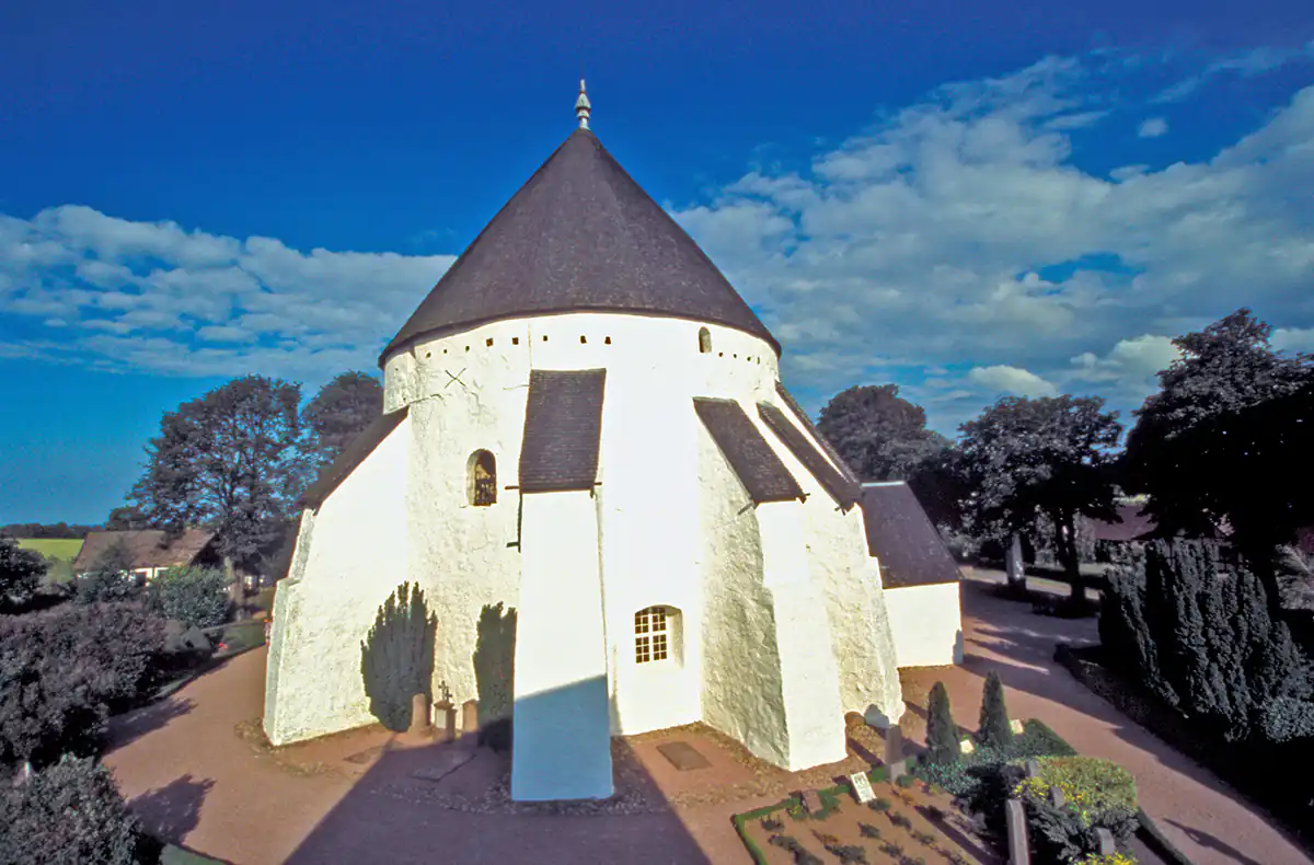
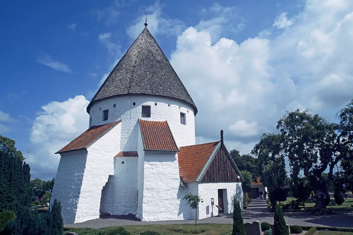
The most famous of the ancient constructions of Bornholm Island are its medieval round churches. The current hypothesis among historians is that these structures were not intended solely for religious practices but also had a defensive function. Given their assumed construction period in the 12th century, this seems to make sense as the Baltic region was then subjected to near-continuous raids by Slavonic pirates from the island of Rugen, off the German coast. Originally, the four churches had flat roofs so they could be defended from any angle, but the cone-shaped roofs were not added until several centuries later.
Upon deeper consideration, however, the idea that the churches were used for defensive purposes makes little sense when one considers the limited space within the churches. Each of the four round churches, except for Nyker, has three floors, but the lower floor has limited space because of the enormous central pillar, and the upper two floors are too small and cramped to accommodate more than a few dozen people. Additionally, if places of refuge were needed during times of attack, it would have been far more logical for the population to have gathered within the fortresses of Gamleborg and Lilleborg, which were vastly more secure and defensible during the time of the supposed pirate raids.
There are still more mysteries to these four round churches that the conventional historical interpretation cannot explain. What was the purpose of the round shape, and from where did it architecturally originate? While there are scores of other churches dating from the same time throughout Denmark and other parts of Scandinavia, there are no other churches with the distinctive round shape of the Bornholm buildings. Equally mysterious is the location of the four round churches relative to one another, the geography of Bornholm and the nearby islet of Christianso (12.5 miles northeast of Bornholm). In other words, who built these churches, and for what purpose?
To find answers to these questions, two researchers looked beyond the conventional historical interpretation and were repeatedly led to the medieval religious order of the Knights Templar. In their book, The Templars' Secret Island, Erling Haagensen and Henry Lincoln present evidence linking the four round churches of Bornholm with the Templars' controversial and much misunderstood religious brotherhood. According to these authors, the location of the four round churches of Osterlars, Nylars, Olsker, and Nyker indicates a complex but beautiful pattern of landscape geometry incorporating three, four, five, six, and seven-sided figures. In addition, the round churches reveal the key to further landscape geometry, which is linked to the other medieval churches on Bornholm and nearby Christianso, and is also mirrored in the extraordinary landscape geometry of Rennes le Chateau in southern France.
Historically, it is known that the original nine founders of the Templars spent nine years secretly excavating hidden passages beneath the Temple of Solomon on Mount Zion in Jerusalem, after which they unexplainably became immensely wealthy. What did the nine Templar knights find: great wealth, objects of mysterious power, texts of secret esoteric teachings, or all these things? What was the connection between the Templar knights and the explosively rapid development of the Cistercian monastic order that has so many fascinating connections with early Christianity in Scandinavia and Bornholm? And, if vast treasures were discovered beneath the Solomon's Temple, where were those treasures then hidden away? Geo-radar surveys conducted at the Osterlars church on Bornholm and the church of Rennes le Chateau have revealed what seem to be previously unknown crypts beneath the church floors. Did the Templars store their treasures at these sites?
Haagensen and Lincoln have done pioneering work in analyzing Bornholm's sacred geography, but the authors believe that deeper and more esoteric secrets remain to be discovered. The celestial alignments of the island's Neolithic constructions and the round churches need to be studied in more detail (for example, the upper windows in the Osterlars church were positioned to be in alignment with the sunrises of the winter and summer solstices). Additionally, ancient pagan symbols encoded in carvings and frescos found in the four round churches and at Poulsker church in south Bornholm need to be examined with broader knowledge than the conventional historical approach.

Martin Gray is a cultural anthropologist, writer and photographer specializing in the study of pilgrimage traditions and sacred sites around the world. During a 40 year period he has visited more than 2000 pilgrimage places in 160 countries. The World Pilgrimage Guide at sacredsites.com is the most comprehensive source of information on this subject.


